Optical and Sar Remote Sensing of Urban Areas: A Practical Guide
暫譯: 城市區域的光學與合成孔徑雷達遙感:實用指南
Kamusoko, Courage
- 出版商: Springer
- 出版日期: 2021-12-03
- 售價: $3,520
- 貴賓價: 9.5 折 $3,344
- 語言: 英文
- 頁數: 124
- 裝訂: Hardcover - also called cloth, retail trade, or trade
- ISBN: 9811651485
- ISBN-13: 9789811651489
海外代購書籍(需單獨結帳)
商品描述
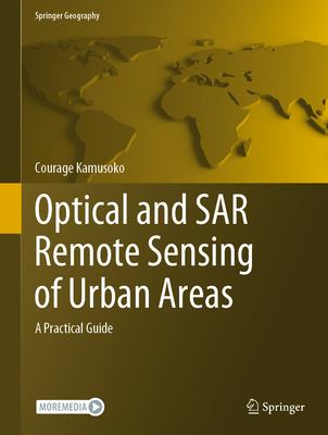
This book introduces remotely sensed image processing for urban areas using optical and synthetic aperture radar (SAR) data and assists students, researchers, and remote sensing practitioners who are interested in land cover mapping using such data. There are many introductory and advanced books on optical and SAR remote sensing image processing, but most of them do not serve as good practical guides. However, this book is designed as a practical guide and a hands-on workbook, where users can explore data and methods to improve their land cover mapping skills for urban areas. Although there are many freely available earth observation data, the focus is on land cover mapping using Sentinel-1 C-band SAR and Sentinel-2 data. All remotely sensed image processing and classification procedures are based on open-source software applications such QGIS and R as well as cloud-based platforms such as Google Earth Engine (GEE).
The book is organized into six chapters. Chapter 1 introduces geospatial machine learning, and Chapter 2 covers exploratory image analysis and transformation. Chapters 3 and 4 focus on mapping urban land cover using multi-seasonal Sentinel-2 imagery and multi-seasonal Sentinel-1 imagery, respectively. Chapter 5 discusses mapping urban land cover using multi-seasonal Sentinel-1 and Sentinel-2 imagery as well as other derived data such as spectral and texture indices. Chapter 6 concludes the book with land cover classification accuracy assessment.
商品描述(中文翻譯)
本書介紹了使用光學和合成孔徑雷達(SAR)數據進行城市區域的遙感影像處理,並協助對使用這些數據進行土地覆蓋圖製作感興趣的學生、研究人員和遙感從業者。雖然有許多關於光學和SAR遙感影像處理的入門和進階書籍,但大多數並不作為良好的實用指南。然而,本書旨在作為一本實用指南和動手操作的工作手冊,使用者可以探索數據和方法,以提高他們在城市區域的土地覆蓋圖製作技能。儘管有許多免費的地球觀測數據,但本書的重點是使用Sentinel-1 C波段SAR和Sentinel-2數據進行土地覆蓋圖製作。所有的遙感影像處理和分類程序均基於開源軟體應用程式,如QGIS和R,以及基於雲端的平台,如Google Earth Engine(GEE)。
本書共分為六章。第一章介紹地理空間機器學習,第二章涵蓋探索性影像分析和轉換。第三章和第四章分別專注於使用多季節的Sentinel-2影像和多季節的Sentinel-1影像進行城市土地覆蓋圖製作。第五章討論使用多季節的Sentinel-1和Sentinel-2影像以及其他衍生數據(如光譜和紋理指數)進行城市土地覆蓋圖製作。第六章以土地覆蓋分類準確性評估作為本書的結尾。
作者簡介
Courage Kamusoko is an independent geospatial consultant based in Japan. His expertise includes land use and cover change modeling, and the design and implementation of geospatial database management systems. His primary research involves analyses of remotely sensed images, land use and cover modeling, and machine learning. In addition to his focus on geospatial research and consultancy, he has dedicated his time to teaching practical machine learning for geospatial analysis and modeling. Recently, he published the book Remote Sensing Image Classification in R (Springer).
作者簡介(中文翻譯)
Courage Kamusoko 是一位位於日本的獨立地理空間顧問。他的專業領域包括土地使用與覆蓋變化建模,以及地理空間資料庫管理系統的設計與實施。他的主要研究涉及遙感影像分析、土地使用與覆蓋建模,以及機器學習。除了專注於地理空間研究與顧問工作外,他還致力於教授地理空間分析與建模的實用機器學習。最近,他出版了書籍《Remote Sensing Image Classification in R》(Springer)。


