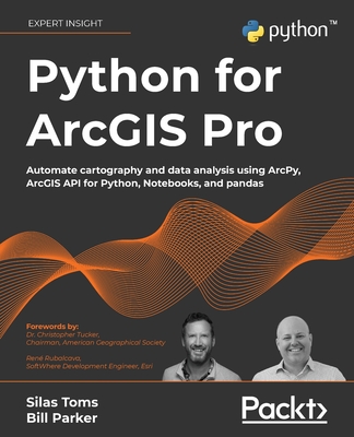
Python for ArcGIS Pro: Automate cartography and data analysis using ArcPy, ArcGIS API for Python, Notebooks, and pandas
暫譯: ArcGIS Pro 的 Python:使用 ArcPy、ArcGIS API for Python、Notebooks 和 pandas 自動化製圖與數據分析
Silas Toms , Bill Parker
- 出版商: Packt Publishing
- 出版日期: 2022-04-29
- 售價: $2,570
- 貴賓價: 9.5 折 $2,442
- 語言: 英文
- 頁數: 586
- 裝訂: Quality Paper - also called trade paper
- ISBN: 1803241667
- ISBN-13: 9781803241661
-
相關分類:
Python、程式語言、地理資訊系統 Gis、Data Science
-
相關翻譯:
ArcGIS Pro Python 編程 (簡中版)
商品描述
Key Features
- Learn the core components of the two Python modules for ArcGIS: ArcPy and ArcGIS API for Python
- Use ArcPy, pandas, NumPy, and ArcGIS in ArcGIS Pro Notebooks to manage and analyze geospatial data at scale
- Integrate with ArcGIS Online using Python to publish and manage data
Book Description
Integrating Python into your day-to-day ArcGIS work is highly recommended when dealing with large amounts of geospatial data. Python for ArcGIS Pro aims to help you get your work done faster, with greater repeatability and higher confidence in your results.
Starting from programming basics and building in complexity, two experienced ArcGIS professionals-turned-Python programmers teach you how to incorporate scripting at each step: automating the production of maps for print, managing data between ArcGIS Pro and ArcGIS Online, creating custom script tools for sharing, and then running data analysis and visualization on top of the ArcGIS geospatial library, all using Python.
You'll use ArcGIS Pro Notebooks to explore and analyze geospatial data, and write data engineering scripts to manage ongoing data processing and data transfers. This exercise-based book also includes three rich real-world case studies, giving you an opportunity to apply and extend the concepts you studied earlier.
Irrespective of your expertise level with Esri software or the Python language, you'll benefit from this book's hands-on approach, which takes you through the major uses of Python for ArcGIS Pro to boost your ArcGIS productivity.
What you will learn
- Automate map production to make and edit maps at scale, cutting down on repetitive tasks
- Publish map layer data to ArcGIS Online
- Automate data updates using the ArcPy Data Access module and cursors
- Turn your scripts into script tools for ArcGIS Pro
- Learn how to manage data on ArcGIS Online
- Query, edit, and append to feature layers and create symbology with renderers and colorizers
- Apply pandas and NumPy to raster and vector analysis
- Learn new tricks to manage data for entire cities or large companies
Who this book is for
This book is ideal for anyone looking to add Python to their ArcGIS Pro workflows, even if you have no prior experience with programming. This includes ArcGIS professionals, intermediate ArcGIS Pro users, ArcGIS Pro power users, students, and people who want to move from being a GIS Technician to GIS Analyst; GIS Analyst to GIS Programmer; or GIS Developer/Programmer to a GIS Architect. Basic familiarity with geospatial/GIS syntax, ArcGIS, and data science (pandas) is helpful, though not necessary.
商品描述(中文翻譯)
#### 主要特點
- 學習 ArcGIS 的兩個 Python 模組的核心組件:ArcPy 和 ArcGIS API for Python
- 在 ArcGIS Pro Notebooks 中使用 ArcPy、pandas、NumPy 和 ArcGIS 來管理和分析大規模的地理空間數據
- 使用 Python 與 ArcGIS Online 整合,以發布和管理數據
#### 書籍描述
在處理大量地理空間數據時,將 Python 整合到日常的 ArcGIS 工作中是非常推薦的。《Python for ArcGIS Pro》旨在幫助您更快地完成工作,並提高結果的重複性和信心。
從編程基礎開始,逐步增加複雜性,兩位經驗豐富的 ArcGIS 專業人士轉型為 Python 程式設計師,教您如何在每個步驟中融入腳本:自動化地圖的印刷製作、管理 ArcGIS Pro 和 ArcGIS Online 之間的數據、創建自定義腳本工具以便分享,然後在 ArcGIS 地理空間庫上運行數據分析和可視化,全部使用 Python。
您將使用 ArcGIS Pro Notebooks 探索和分析地理空間數據,並編寫數據工程腳本來管理持續的數據處理和數據傳輸。這本以實作為基礎的書籍還包括三個豐富的真實案例研究,讓您有機會應用和擴展您之前學習的概念。
無論您對 Esri 軟體或 Python 語言的專業程度如何,您都將從這本書的實作方法中受益,這將引導您了解 Python 在 ArcGIS Pro 中的主要用途,以提升您的 ArcGIS 生產力。
#### 您將學到的內容
- 自動化地圖製作,以大規模製作和編輯地圖,減少重複性任務
- 將地圖圖層數據發布到 ArcGIS Online
- 使用 ArcPy Data Access 模組和游標自動化數據更新
- 將您的腳本轉換為 ArcGIS Pro 的腳本工具
- 學習如何在 ArcGIS Online 上管理數據
- 查詢、編輯和附加到要素圖層,並使用渲染器和顏色化工具創建符號化
- 將 pandas 和 NumPy 應用於光柵和矢量分析
- 學習管理整個城市或大型公司的數據的新技巧
#### 本書適合誰
這本書非常適合任何希望將 Python 添加到其 ArcGIS Pro 工作流程中的人,即使您沒有編程的先前經驗。這包括 ArcGIS 專業人士、中級 ArcGIS Pro 使用者、ArcGIS Pro 高級使用者、學生,以及希望從 GIS 技術員轉型為 GIS 分析師;從 GIS 分析師轉型為 GIS 程式設計師;或從 GIS 開發者/程式設計師轉型為 GIS 架構師的人士。對地理空間/GIS 語法、ArcGIS 和數據科學(pandas)有基本的熟悉程度會有所幫助,但並非必要。
作者簡介
Silas Toms is a long-time geospatial professional and author who has previously published ArcPy and ArcGIS and Mastering Geospatial Analysis with Python. His career highlights include developing the real-time common operational picture used at Super Bowl 50, building geospatial software for autonomous cars, designing computer vision for next-gen insurance, and developing mapping systems for Zillow. He now works at Volta Charging, predicting the future of electric vehicle adoption and electric charging infrastructure.
Bill Parker is a GIS Professional with over 15 years of GIS and Python experience. He previously worked at ICF as a GIS lead on large scale environmental projects, using ArcPy to automate GIS analyses and map production. His project highlights include being the GIS lead for the Caltrain Modernization EIR/S, California High Speed Rail Project San Jose to Merced, and San Francisco to San Jose EIR/S.
作者簡介(中文翻譯)
Silas Toms 是一位長期從事地理空間專業的專家和作者,曾出版過《ArcPy 和 ArcGIS》以及《用 Python 精通地理空間分析》。他的職業亮點包括開發在超級碗 50 中使用的實時共同作戰圖、為自駕車構建地理空間軟體、為下一代保險設計計算機視覺,以及為 Zillow 開發地圖系統。他目前在 Volta Charging 工作,預測電動車的採用未來及電動充電基礎設施。
Bill Parker 是一位 GIS 專業人士,擁有超過 15 年的 GIS 和 Python 經驗。他曾在 ICF 擔任 GIS 領導,負責大型環境項目,使用 ArcPy 自動化 GIS 分析和地圖製作。他的項目亮點包括擔任 Caltrain 現代化環境影響報告/聲明(EIR/S)、加州高鐵項目聖荷西至梅塞德以及舊金山至聖荷西的 EIR/S 的 GIS 領導。
目錄大綱
Table of Contents
- Introduction to Python for GIS
- Basics of ArcPy
- ArcGIS API for Python
- The Data Access Module and Cursors
- Publishing to ArcGIS Online
- ArcToolbox Script Tools
- Automated Map Production
- Pandas, Data Frames, and Vector Data
- Raster Analysis with Python
- Geospatial Data Processing with NumPy
- Case Study: ArcGIS Online Administration and Data Management
- Case Study: Advanced Map Automation
- Case Study: Predicting Crop Yields
目錄大綱(中文翻譯)
Table of Contents
- Introduction to Python for GIS
- Basics of ArcPy
- ArcGIS API for Python
- The Data Access Module and Cursors
- Publishing to ArcGIS Online
- ArcToolbox Script Tools
- Automated Map Production
- Pandas, Data Frames, and Vector Data
- Raster Analysis with Python
- Geospatial Data Processing with NumPy
- Case Study: ArcGIS Online Administration and Data Management
- Case Study: Advanced Map Automation
- Case Study: Predicting Crop Yields


