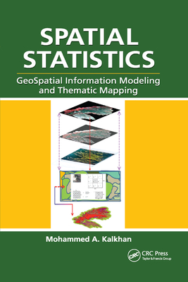
Spatial Statistics: Geospatial Information Modeling and Thematic Mapping
暫譯: 空間統計學:地理空間資訊建模與主題地圖製作
Kalkhan, Mohammed A.
- 出版商: CRC
- 出版日期: 2020-09-30
- 售價: $2,720
- 貴賓價: 9.5 折 $2,584
- 語言: 英文
- 頁數: 184
- 裝訂: Quality Paper - also called trade paper
- ISBN: 0367865629
- ISBN-13: 9780367865627
-
相關分類:
地理資訊系統 Gis
海外代購書籍(需單獨結帳)
相關主題
商品描述
Geospatial information modeling and mapping has become an important tool for the investigation and management of natural resources at the landscape scale. Spatial Statistics: GeoSpatial Information Modeling and Thematic Mapping reviews the types and applications of geospatial information data, such as remote sensing, geographic information systems (GIS), and GPS as well as their integration into landscape-scale geospatial statistical models and maps.
The book explores how to extract information from remotely sensed imagery, GIS, and GPS, and how to combine this with field data--vegetation, soil, and environmental--to produce a spatial model that can be reconstructed and displayed using GIS software. Readers learn the requirements and limitations of each geospatial modeling and mapping tool. Case studies with real-life examples illustrate important applications of the models.
Topics covered in this book include:
- An overview of the geospatial information sciences and technology and spatial statistics
- Sampling methods and applications, including probability sampling and nonrandom sampling, and issues to consider in sampling and plot design
- Fine and coarse scale variability
- Spatial sampling schemes and spatial pattern
- Linear and spatial correlation statistics, including Moran's I, Geary's C, cross-correlation statistics, and inverse distance weighting
- Geospatial statistics analysis using stepwise regression, ordinary least squares (OLS), variogram, kriging, spatial auto-regression, binary classification trees, cokriging, and geospatial models for presence and absence data
- How to use R statistical software to work on statistical analyses and case studies, and to develop a geospatial statistical model
商品描述(中文翻譯)
地理空間資訊建模與繪圖已成為在景觀尺度上調查和管理自然資源的重要工具。《空間統計:地理空間資訊建模與主題繪圖》回顧了地理空間資訊數據的類型和應用,例如遙感、地理資訊系統(GIS)和全球定位系統(GPS),以及它們如何整合進入景觀尺度的地理空間統計模型和地圖中。
本書探討如何從遙感影像、GIS 和 GPS 中提取資訊,並如何將這些資訊與現場數據(如植被、土壤和環境)結合,以產生可以使用 GIS 軟體重建和顯示的空間模型。讀者將了解每種地理空間建模和繪圖工具的要求和限制。真實案例研究展示了這些模型的重要應用。
本書涵蓋的主題包括:
- 地理空間資訊科學與技術及空間統計的概述
- 抽樣方法及應用,包括概率抽樣和非隨機抽樣,以及在抽樣和地塊設計中需考慮的問題
- 精細與粗略尺度的變異性
- 空間抽樣方案和空間模式
- 線性和空間相關統計,包括莫蘭指數(Moran's I)、基瑞指數(Geary's C)、交叉相關統計和反距離加權
- 使用逐步回歸、普通最小二乘法(OLS)、變異數圖(variogram)、克里金法(kriging)、空間自迴歸、二元分類樹、共克里金法(cokriging)和針對存在與缺失數據的地理空間模型進行地理空間統計分析
- 如何使用 R 統計軟體進行統計分析和案例研究,並開發地理空間統計模型
作者簡介
Dr. Mohammed A. Kalkhan has over 20 years experience in research and teaching at Colorado State University in Fort Collins, Colorado. As a member of the Natural Resource Ecology Laboratory (NREL) there, he has also served as an affiliate faculty in the Department of Forest, Rangeland, and Watershed Stewardship, and as an advisor for the Interdisciplinary Graduate Certificate in Geospatial Science, Graduate Degree Program in Ecology (GDPE), The School of Global Environmental Sustainability (SOGES), and Department of Earth Resources (currently the Department of Geosciences) at Colorado State University (CSU).
Dr. Kalkhan received his BSc in Forestry (1973) and MSc in Forest Mensuration (1980) from the College of Agriculture and Forestry, the University of Mosul, Iraq. He received his PhD in forest biometrics- remote sensing applications from the Department of Forest Sciences at Colorado State University, USA, in 1994. From 1975 to 1982, he was a lecturer in the Department of Forestry, College of Agriculture and Forestry, University of Mosul. In 1994, he joined the Natural Resource Ecology Laboratory.
Dr. Kalkhan's main interests are in the integration of field data, remote sensing, and GIS with geospatial statistics to understand landscape parameters through the use of a complex model with thematic mapping approaches, including sampling methods and designs, biometrics, determination of uncertainty and mapping accuracy assessment.
作者簡介(中文翻譯)
穆罕默德·A·卡爾汗博士在科羅拉多州立大學(Colorado State University)擁有超過20年的研究和教學經驗,該校位於科羅拉多州的福特柯林斯。作為自然資源生態實驗室(Natural Resource Ecology Laboratory, NREL)的成員,他還擔任森林、草原和流域管理系的附屬教員,以及地理空間科學跨學科研究生證書、環境生態研究生學位課程(Graduate Degree Program in Ecology, GDPE)、全球環境可持續性學院(School of Global Environmental Sustainability, SOGES)和地球資源系(目前為地球科學系)的顧問。
卡爾汗博士於1973年獲得伊拉克摩蘇爾大學農業與林業學院的林業學士學位,並於1980年獲得森林測量碩士學位。他於1994年在美國科羅拉多州立大學森林科學系獲得森林生物統計學及遙感應用的博士學位。從1975年到1982年,他在摩蘇爾大學農業與林業學院的林業系擔任講師。1994年,他加入自然資源生態實驗室。
卡爾汗博士的主要研究興趣在於將現場數據、遙感技術和地理資訊系統(GIS)與地理空間統計學相結合,通過使用複雜模型和主題映射方法來理解景觀參數,包括取樣方法和設計、生物統計學、不確定性確定和映射精度評估。


